How GPS Became Invisible Infrastructure: Satellites, Smartphones and Precise Time
From Cold War navigation experiments to the positioning and timing utility behind maps, mobile networks, finance and power systems.
What GPS Really Does
GPS is usually described as a navigation system, but that understates its role. A GPS receiver calculates position by measuring how long precisely timed radio signals take to arrive from multiple satellites. Because those satellites carry highly stable atomic clocks, the same system also distributes precise time. That timing function quietly supports mobile networks, financial systems, power grids, data centres and many other services that never display a map.
From Military Navigation to Everyday Infrastructure
The history of GPS is therefore not only a story about satellites. It is also a story about clocks becoming accurate enough to measure distance from space, civilian access becoming progressively more useful, receivers shrinking from specialised military hardware into phones, and satellite navigation evolving from a single US constellation into a multi-GNSS ecosystem. The milestones below trace that shift from Cold War experiment to invisible global infrastructure.
-
Precursor
Sputnik's radio signal reveals navigation by Doppler shift
Scientists tracking Sputnik found that its changing radio frequency could reveal the satellite's orbit. Reversing the calculation suggested that a known satellite orbit could reveal a receiver's position.
As Sputnik passed overhead, scientists at Johns Hopkins noticed its radio signal shifted pitch the same way a passing ambulance siren does, higher as it approaches, lower as it recedes. This effect is called Doppler shift. By tracking exactly how the pitch changed over time, they could calculate the satellite's orbit precisely. Then they realized the idea could run in reverse: if a satellite's orbit is already known precisely, the Doppler shift of its signal could instead reveal the location of whoever is listening on the ground. That reversal, tracking a receiver instead of a satellite, became the founding idea behind every satellite navigation system that followed.
Sources & references 1 source
-
Precursor
Transit begins operational satellite navigation
The U.S. launched Transit 1B, part of a system developed to update submarine navigation. Fixes were intermittent and slower than modern GPS, but Transit proved navigation satellites could serve operational users.
The U.S. Navy launched Transit 1B to solve a specific problem: submarines needed to know their exact position before firing long-range missiles, but couldn't surface often enough to check landmarks or stars. A submarine could only get a position fix when a Transit satellite happened to pass overhead, roughly once every hour or two, and the calculation itself took several minutes. That's far slower than modern GPS, which updates continuously. But Transit proved the underlying idea from Sputnik tracking worked as a real operational system, not just a research finding, laying essential groundwork before anyone had funded a system meant for everyday, continuous use.
Sources & references 1 source
-
Precursor
The Pentagon approves a unified GPS programme
The U.S. Department of Defense approved NAVSTAR GPS, combining ideas from earlier Navy and Air Force programmes. The design centred on satellites carrying precise clocks and continuous global service.
Before 1973, the Navy and Air Force were separately developing competing satellite navigation systems, each solving pieces of the same problem differently. The Pentagon merged them into a single program, NAVSTAR GPS, built around one core design choice: instead of satellites broadcasting their own position and letting a receiver do complex calculations, each satellite would carry an extremely precise atomic clock and broadcast the exact time. A receiver on the ground could then calculate its own position just by comparing the arrival time of signals from multiple satellites, a much simpler approach that could scale to millions of receivers built by anyone, not just specialized military hardware.
Sources & references 1 source
Continue reading
-
Milestone
The first experimental GPS satellite reaches orbit
NAVSTAR 1 began validating signals, atomic clocks, ground control and receiver designs. The Block I test constellation established the architecture before an operational fleet was funded and deployed.
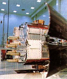
U.S. Air Force NAVSTAR 1 wasn't meant to provide navigation service to anyone. It was a test satellite, part of a small experimental group called Block I, built to answer engineering questions before the government committed to building a full operational fleet: would the atomic clocks stay accurate enough in orbit, could ground control track and correct the satellites reliably, and would receiver designs actually work with real signals from space rather than simulations. Every one of those questions had to be answered before anyone would fund the roughly 24-satellite constellation the finished system would eventually need.
Sources & references 1 source
-
Policy
The United States commits GPS to civilian aviation
After Korean Air Lines Flight 007 was shot down, President Ronald Reagan announced that GPS would be made available for civilian use when operational. Civilian signals later remained intentionally degraded for years.
Korean Air Lines Flight 007 strayed off course into Soviet airspace and was shot down, killing everyone aboard. The tragedy traced back to a basic navigation error that better positioning technology could have prevented. In response, President Reagan announced that once GPS became fully operational, its signal would be made available to civilian aircraft worldwide, free of charge, specifically to prevent similar navigation disasters. That commitment came with a catch that wouldn't become public knowledge for years: the U.S. military planned to deliberately scramble the civilian signal's accuracy, a policy called Selective Availability, reserving the most precise positioning for its own systems.
Sources & references 1 source
-
Milestone
A 24-satellite constellation reaches initial operational capability
With enough satellites available, GPS could provide three-dimensional position and timing worldwide. Full operational capability followed in 1995, turning decades of tests into a dependable service.
With 24 satellites finally in orbit, enough were visible from any point on Earth at any time to calculate a position in three dimensions, latitude, longitude, and altitude, rather than the intermittent two-dimensional fixes earlier systems like Transit provided. This was declared initial operational capability, meaning the system was reliable enough for the military to depend on, though engineers were still fine-tuning it. Full operational capability, the point where every promised feature worked to specification, followed in 1995. Two decades after the Pentagon merged competing programs, GPS had become the continuous, dependable utility it was originally designed to be, rather than an intermittent research tool.
Sources & references 1 source
-
Milestone
GPS reaches full operational capability
By 1995, GPS had moved beyond experimental and initial service into a fully operational global utility, completing the military architecture that civilian and commercial uses would soon build upon.
After initial operational capability was declared in 1993, the constellation and control system continued maturing until GPS reached full operational capability in 1995. This marked the point at which the system was no longer primarily an experimental programme or partial service: the space, control and user segments together could provide continuous global positioning, navigation and timing. The milestone mattered far beyond defence because it created a stable platform on which civil aviation, surveying, transportation and later consumer applications could grow.
Sources & references 1 source
-
Milestone
Selective Availability ends and civilian accuracy jumps
President Bill Clinton ordered the end of Selective Availability, the deliberate degradation of civilian GPS. Overnight, typical civilian accuracy improved roughly tenfold and commercial location services gained a stronger foundation.
For its first two decades of civilian use, GPS had deliberately degraded accuracy for non-military users, keeping typical civilian position errors around 100 meters even though the underlying technology was capable of far better. President Clinton ordered this deliberate degradation, called Selective Availability, switched off entirely. Civilian accuracy improved to roughly 10 meters overnight, without any new satellites or hardware changes, purely by removing an artificial limitation. That single policy decision is what made consumer GPS devices and, later, the location features in smartphones actually useful for things like street-level navigation, rather than only telling you roughly which neighborhood you were in.
Sources & references 1 source
Continue reading
-
Modernization
A second civilian GPS signal begins the modernisation era
The first GPS satellite carrying L2C launched in 2005, giving civilian users a second dedicated frequency and opening the way to better accuracy, reliability and ionospheric correction.
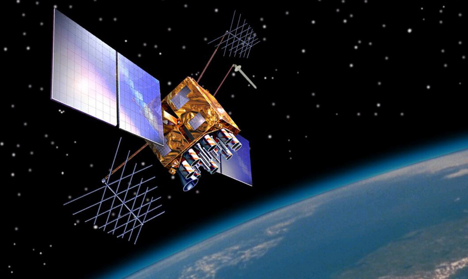
U.S. Air Force The launch of the first GPS IIR-M satellite introduced L2C, the system's second civilian signal. A receiver able to combine L2C with the original L1 civilian signal can compare the two frequencies to estimate and correct part of the delay introduced by Earth's ionosphere. L2C also improved acquisition and reliability for professional users. More importantly, it signalled a change in philosophy: civilian GPS was no longer a legacy by-product of a military system but an explicit target of long-term modernisation.
Sources & references 1 source
Continue reading
-
Adoption
Built-in GPS moves location into the smartphone mainstream
The iPhone 3G launched with built-in GPS and an app platform, helping turn satellite positioning from a specialist feature into an everyday input for maps, transport and location-based applications.
GPS receivers had appeared in mobile phones before 2008, but the combination of built-in GPS, mobile broadband and a large third-party application ecosystem changed how ordinary users interacted with location. Apple's iPhone 3G explicitly promoted built-in GPS for expanded location-based services, while competing smartphone platforms were making the same transition. Once developers could treat location as a standard sensor rather than a separate navigation device, GPS became embedded in ride-hailing, local search, fitness, photography, delivery and thousands of other applications.
Sources & references 1 source
Continue reading
-
Modernization
L5 adds a third civilian frequency for demanding applications
The first GPS IIF satellite with a full L5 transmitter launched in 2010, adding a higher-power civilian signal designed for safety-of-life transportation and more robust multi-frequency positioning.
L5 was designed for applications that need more robustness than the original civilian GPS signal could provide, particularly aviation and other safety-of-life transportation. It uses a protected aeronautical radionavigation band, higher transmitted power and a modern signal design. Combined with L1 and L2C, the third frequency also gives advanced receivers additional ways to detect and correct propagation errors. GPS was becoming not simply more accurate, but more diverse: different civil signals could now be optimised for different classes of users.
Sources & references 1 source
Continue reading
-
Milestone
Galileo begins service and consumer navigation becomes multi-GNSS
Europe's Galileo began Initial Services in 2016 and was designed to interoperate with GPS, accelerating the shift toward receivers that combine several satellite constellations rather than depend on one.
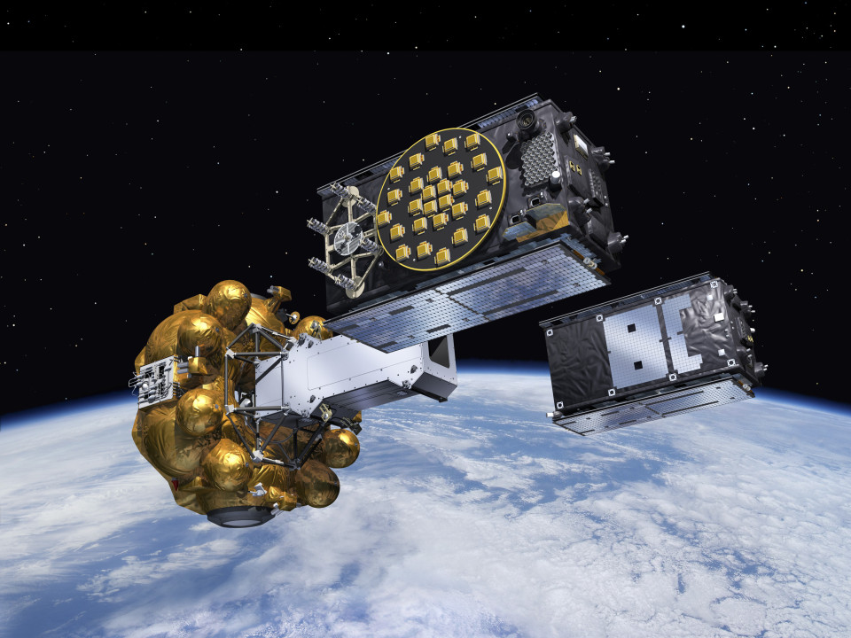
ESA–Pierre Carril When Galileo Initial Services became available, users gained access to another global source of positioning, navigation and timing signals that was explicitly interoperable with GPS. This mattered because modern receivers increasingly stopped asking, 'Can I see enough GPS satellites?' and instead searched across several constellations. More visible satellites can improve availability and geometry, particularly in cities where buildings block large parts of the sky. In everyday devices, 'GPS' was becoming shorthand for a broader multi-GNSS positioning system.
Sources & references 1 source
Continue reading
-
Modernization
The first GPS III satellite starts a new generation
The first GPS III satellite launched in December 2018, beginning a generation built for better accuracy, stronger anti-jam performance, longer service life and improved interoperability.
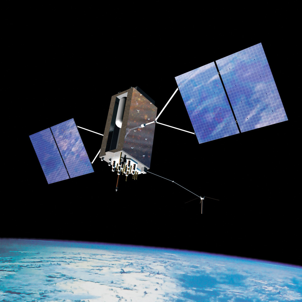
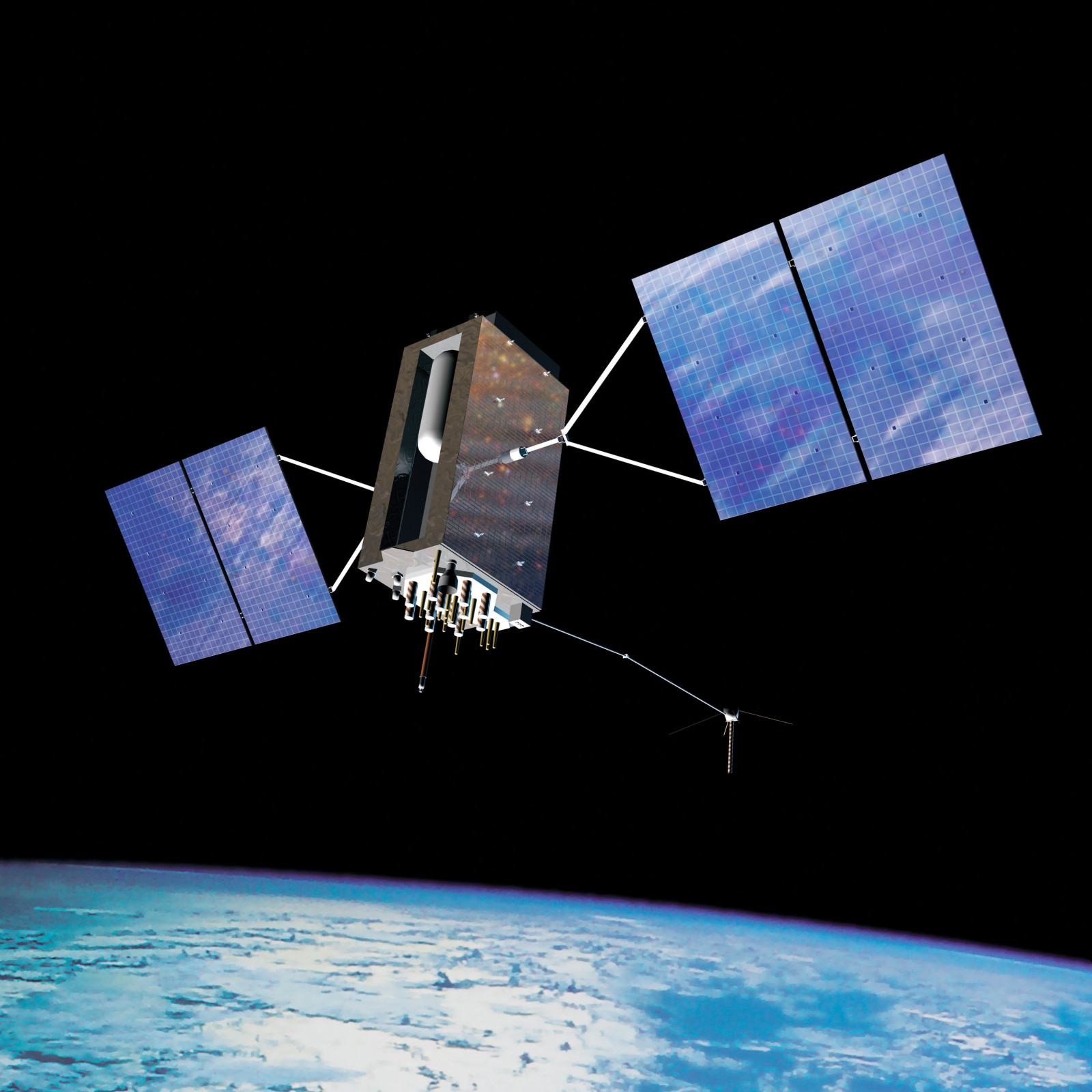
U.S. Air Force GPS III SV01, nicknamed Vespucci, launched on 23 December 2018. The new generation was designed to improve accuracy, signal integrity and resistance to jamming while extending satellite design life. It also introduced the L1C civil signal architecture intended to improve interoperability with other global navigation systems. The launch marked the beginning of the same GPS III generation whose final satellite would reach orbit in 2026, connecting the timeline's modernisation story across nearly a decade.
Sources & references 1 source
Continue reading
-
Milestone
The final GPS III satellite completes an upgraded generation
GPS III-8 launched to join a generation designed for better accuracy, stronger signals and improved resistance to jamming. Modernisation is continuous because the service underpins both daily convenience and national infrastructure.
U.S. Air Force GPS III-8 completed a ten-satellite generation built to fix specific weaknesses that had accumulated over decades: a signal roughly eight times more resistant to deliberate jamming, better accuracy through improved atomic clocks, and a new civilian signal designed to work alongside other countries' satellite navigation systems rather than only the original American design. GPS has quietly become the timing backbone for things far beyond navigation, power grids synchronize using its clock signal, financial transactions get timestamped by it, and cell towers use it to stay coordinated. That dependency is exactly why modernization never really stops: each generation of satellites has to keep working while millions of systems the public never thinks about keep relying on it staying accurate.
Sources & references 1 source
Continue reading
What comes next?
Why GPS Is More Than a Map Pin
A receiver normally needs signals from at least four satellites: three to solve its position in three dimensions and another to correct the receiver's clock. The satellite clocks are far more precise than the clock in a phone or car, so the receiver solves position and time together. That is why GPS is fundamentally a positioning, navigation and timing system rather than just a mapping technology.
GPS vs. GNSS
GPS is the US satellite-navigation constellation. GNSS is the broader category that also includes systems such as Europe's Galileo, China's BeiDou and Russia's GLONASS. Modern phones commonly combine several constellations, which gives them more satellites to choose from and can improve availability and performance in difficult environments such as dense cities.
The Hidden Dependency: Precise Time
Telecom networks use precise timing to coordinate radio networks and hand traffic between cells. Financial and computing systems use accurate timestamps to order events. Power systems use synchronized measurements to understand what is happening across a grid. In these applications, losing GPS may not make a blue location dot disappear; it can instead degrade synchronization deep inside infrastructure.
What Can Go Wrong?
GPS signals reaching Earth are extremely weak. They can be blocked by buildings, reflected before reaching a receiver, deliberately jammed, or replaced with counterfeit signals in a spoofing attack. Modernisation therefore increasingly focuses not only on accuracy, but also on stronger signals, additional frequencies, improved anti-jam capability, multi-constellation receivers and resilient alternatives when satellite navigation is unavailable.
What Comes Next?
GPS III is one stage in a continuing modernisation programme rather than an endpoint. New civilian signals, stronger military signals, better ground control and interoperability with other GNSS constellations are gradually making satellite navigation more accurate and robust. At the same time, dependence on precise satellite timing makes resilience increasingly important: the future of navigation will involve combining GNSS with terrestrial radio, inertial sensors, network positioning and other independent sources rather than relying on one signal alone.